

Changing Seasons
/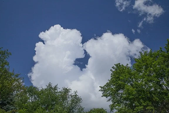
Cumulus congestus is most common on warm humid days but can be seen at other times of the year when the atmosphere is unstable.
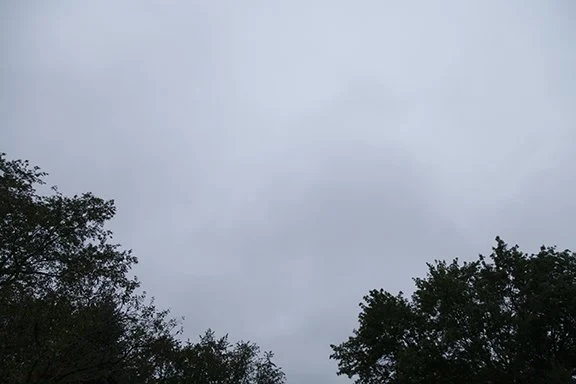
Stratus clouds are found in layers with broad flat bases as shown above. The are strongly associated with the stable air masses of winter but are visible at any time of the year.
September is the first month of autumn and our sky is already showing it. Instead of the puffy cumulus clouds of summer the gray layered sheet clouds (stratus and altostratus) are beginning to dominate the Upper Midwestern sky. Autumn is season of transition. It is a prelude to winter.
For meteorological purposes, September 1st is the beginning of autumn. The autumn months are September, October, and November. Daily weather is usually displayed by month for climatological purposes. But to be exact, the astronomical autumn this year begins on September 22nd. at 8:03 PM CDT. That is when the Sun is directly overhead at the Equator on its way into the Southern Hemisphere. That is the official beginning of autumn for us and the first day of spring for the Southern Hemisphere.
Today a cold front drifted across Iowa from northwest to southeast. The leading edge of the cooler air arrived was very shallow and gently drifted through our area between 5:00 and 6:00 PM. with little fanfare. The wind direction chart from our weather station showed the direction very slowly drifting around from a southerly to a northerly direction between 12:50 and 5:20 PM. There was no sudden increase in wind speeds that would mark a strong cold front.
The left vertical scale is the wind direction in degrees. Zero and 360 are north, 90 is from the east, 180 is from the south, 270 is from the west.
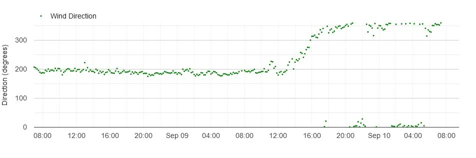
Weather Station Wind Direction Trace
Temperature did not change much either. However, at 4:30 PM the barometric pressure trace began to rise and at 5:30 PM the slope of the rise steepened. At 6:00 PM the temperature trace showed that a stronger cooling trend was underway. From then on the cold front made itself known at temperatures dropped from 78 to 67 in 2 1/2 hours.
Temperature is in red, dotted green is dew point, and dashed blue line is relative humidity.
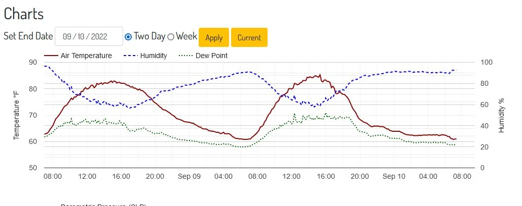
Temperature, dew Point, and Relative Humidity

Barometric Pressure
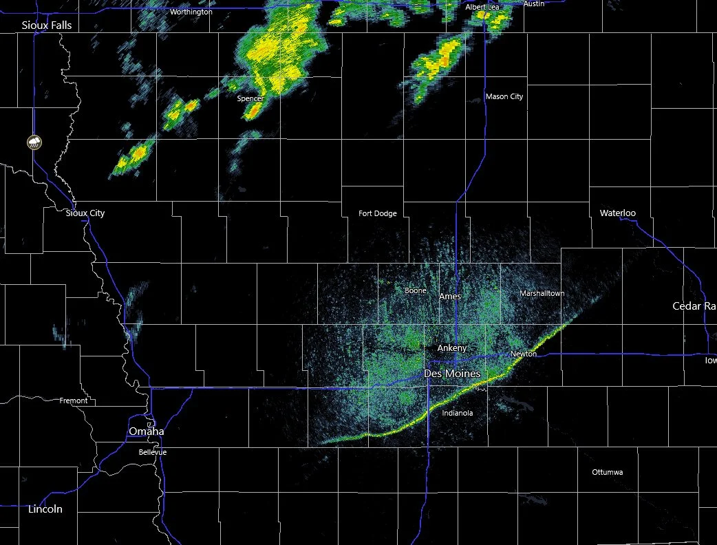
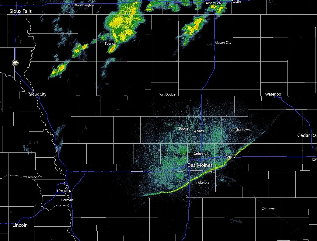
National Weather Service, Des Moines, Iowa, showing the cold front in south Central Iowa. The radar does not show the entire front to the northeast and southwest because it is too far from the radar to be visible. Showers are located over northern Iowa.
The radar image from the National Weather Service Office in Des Moines, Iowa revealed the front in central Iowa. It it shows up as a thin yellow line caused by a change in the air density along the front. The front appears to disappear on the northeast and southwest ends but it extends northeast and southwest.
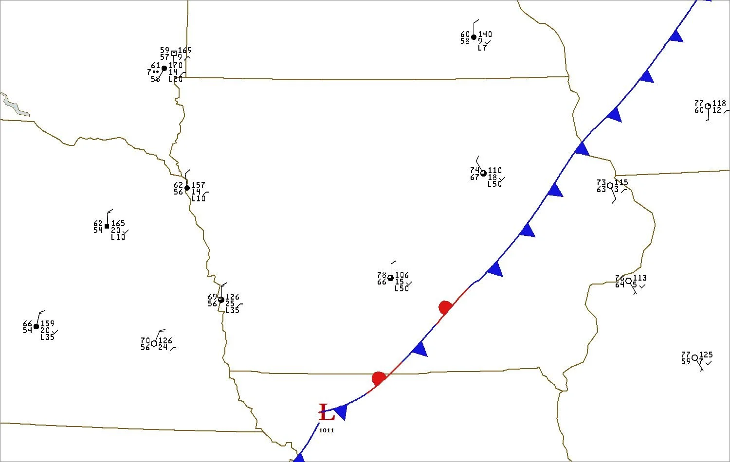
The front shows up in the wind observations. Winds are from the north behind the front and from the south and southeast ahead of it. The wind direction at Waterloo, Iowa is from the northwest. The wind speed is 10 knots which is 11.5 mph.
See the Station Model Plot explanation beginning on this webpage. Waterloo is located behind the front in northeast Iowa. The front is actually a little southeast of Waterloo at this time. I have included a map plotted by Digital Atmosphere (software available at www.weathergraphics.com.
This is a good example of how fronts can be located using data from weather observations, and in this case, sometimes on weather radar. Boundaries such as this cold front show up near the radar because at longer distances the radar beam overshoots the frontal boundary.