Wavy Air
/
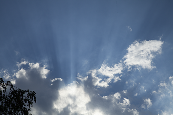
Stratocumulus Cloud on 9-25-2019. Photo by Craig Johnson
When we hear the word “waves,” we think of waves on lakes, ocean, or in rivers. We may not think of waves being in the air. But they are there and they are an important part of our weather and climate system.
When I was young I made waves in the bathtub by vibrating one hand on the surface of the water. The waves would look similar to what is visible in the photo above. When I used two hands, I created waves that came from two different directions. When the waves met, the patterns changed. Sometimes I would make the waves meet head-on; sometimes one set of waves would cross perpendicular to the other waves. The patterns would resemble forms that appear in clouds. It dawned on me that maybe the atmosphere had similar waves. Years later when I was studying physics we were able to use a wave generator that allowed us to make waves from a single source or multiple sources. Many different patterns formed. Many of those patterns are visible in our sky.
The photo below from NASA shows clouds associated with gravity waves. Imagine waves in water and then look at the curved cloud bands in the photo. The crest of the waves is where the clouds are found. That is where the air is rising. The clear banding in between the clouds occurs where the air is sinking.

Photo courtesy of NASA.
Gravity waves form where air is stable. Something puts the air in motion and waves oscillate between the crest and trough (top and bottom of the wave) while trying to return to equilibrium. When waves return to equilibrium the air flow becomes smooth again. Stability is important to the process. Without it the initial up and down motion may grow without stabilizing. An interesting fact:
What causes the waves in the first place? A thunderstorm billowing skyward pushes air out of the way. The air vibrates, moving up and down violently sending gravity waves out from the storm. Air moving over mountains causes gravity waves as the air flow ripples. So does wind shear (a change in wind direction and speed with height). The change creates a force that causes air to move up and down as it travels downstream. Eventually the waves will smooth out but along the way the air ripples. If clouds form the waves become visible. If there are no clouds the waves are invisible.
Gravity waves are important. They help dissipate the energy that builds in the atmosphere as the Sun heats the earth. The waves are part of the Earth’s energy balance. After-all, that’s what the atmosphere does. Day and night, 24-7, it works to balance the imbalances set up by the heating of the earth. They also may causes changes when they encounter thunderstorms and tornadoes - other other atmospheric phenomenon. They may even help start thunderstorms. Who knew that playing with waves in the bath tub could lead to this?
Other planets have gravity waves too. Check out Jupiter by clicking here.