Clouds of the Day - Cirrus uncinus - Wednesday, April 17, 2024

Text to be added.

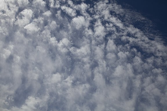
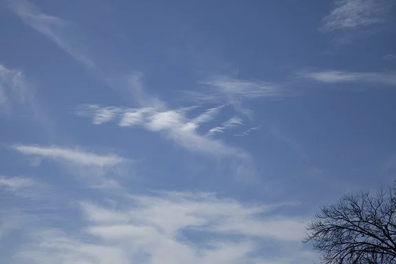
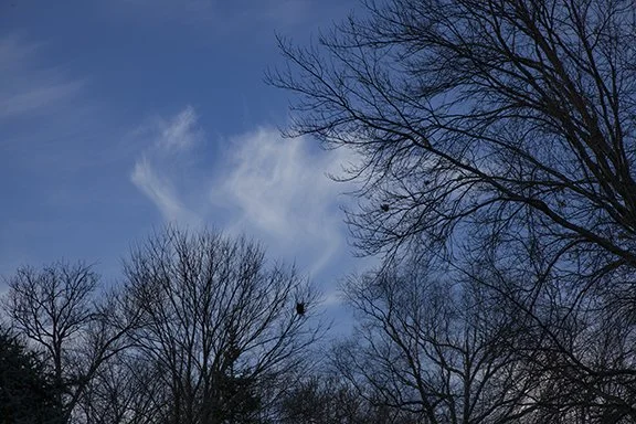
Close-up of Cirrus uncinus - These hook shaped clouds occur when ice crystals fall into slower moving air below the higher cloud head.

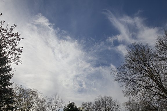
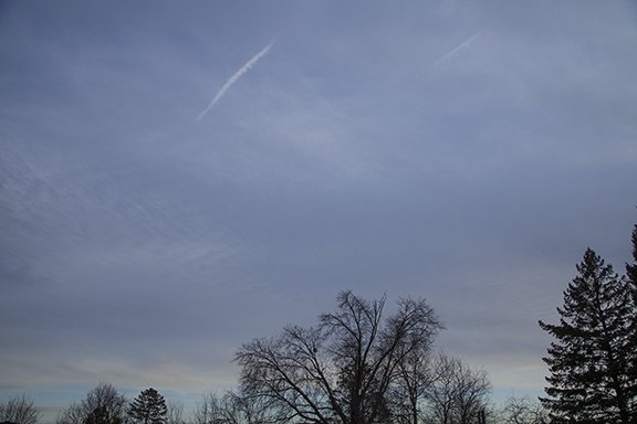
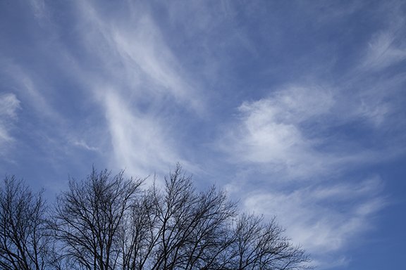
Medium view of the hook-shaped Cirrus uncinus located across the center of the photo.

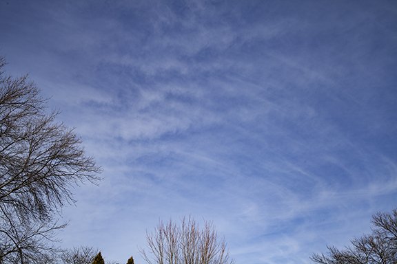
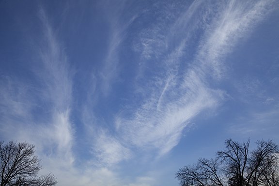
The widest view of the same area of sky. Most of the Cirrus uncinus are found near the bottom of the photo. The Cirrus in the top half of the photo are mostly Cirrus vertebratus because they look like a spine with cloud filaments extending perpendicular away from the main cloud. In the middle are Cirrus floccus that look like clumps of wool.

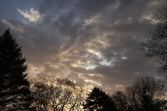
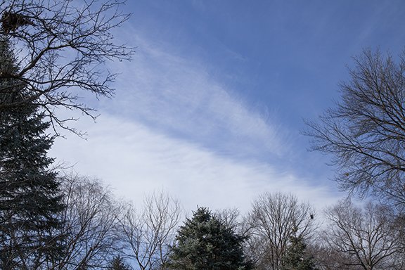
Most of the cloud visible in this photo is what is left of wind-blown cumulus. Wind gusts were blowing the weak updrafts of Cumulus around tearing the cumulus apart. There are altostratus on the left side of the photo.

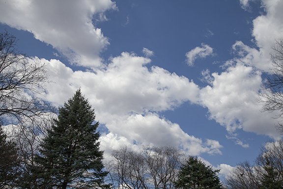
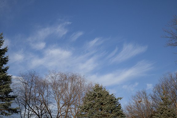
There is wind blown cumulus in the foreground with Cirrostratus in the background (right sight) and Cirrus patches (top center and left).

Clouds of the Day - More Cumulus - Wednesday, April 11, 2024

Cumulus are back to day as temperatures have warmed into the low 70s. The increasing power of the Sun is notable as it rises higher in the sky. This will continue until the first day of summer when the Sun will reach its highest point in the sky. From then on its elevation will slowly decrease as we gradually move toward fall.

In the meantime we will move through spring to summer and warmer weather. That means taller clouds fueled by increasing moisture and showers and thunderstorms. Read more about the change of seasons HERE.

Cumulus in the late morning as temperatures increase.

Cumulus with Cirrostratus above in the background.

Dark bases of Cumulus.

Clouds of the Day - 2024 Eclipse from Missouri - April 8, 2024

We traveled to southeastern Missouri to get as close as we could to the eclipse center line and favorable sky conditions. The series of photos below shows how the sky changed from before to during the total eclipse. The first three photos were taken before the eclipse was total. The fourth photo was taken as the dark umbra part of the shadow was approaching from the southwest. The final two photos were taken during totality which shows the ring of light that is visible in all directions at the outer edge of the shadow.

My favorite photos are the last three in this post. As the umbra approaches the sky to the southwest began to show a nebulous dusty look. Before it arrived the color of the sunlight gradually dimmed in the penumbra shadow. The moment the Moon fully covered the Sun the direct light from the Sun went dark with the only light visible being around the full 360 degree horizon as seen in the bottom two photos. The dark was in sharp contrast to the light around the horizon. We did see stars in the “night” sky. The were actually the planet Venus near the Sun and Jupiter low in the east and a star near the Sun.

During the partial Eclipse

During the partial eclipse

During the partial Eclipse

Just a moment before reaching totality we could see the approaching shadow.

The photo above is looking southwest as the umbra (darkest part of the shadow) approached. Notice the pale lighting on the trees in the foreground.

Below are two photos taken during totality. The sky is dark except for the ring of bright sky near the horizon where light from beyond the edge of the umbra shadow is visible.

Here is a description of the umbra and penumbra portions of the shadow by NASA. CLICK HERE.

During totality there was a ring of perpetual twilight around the 360 degree horizon. Note the dark sky overhead.

Looking in every direction we saw a perpetual twilight ring of light in all directions. Note the dark sky overhead.

Clouds of the Day - CONTRAIL - March 27, 2023

This photo of sunset shows the unusual path of an aircraft. The “man made” cloud formed as the contrail gradually spread out along the path of water vapor that exited the engines. The cold upper level air condensed the water vapor into this cloud that likely contains both ice crystals and cloud droplets. Look closely below the base of the top curved portion of the CONTRAIL. Streamers of ice crystals are visible trailing the cloud.

Clouds of the Day - Air Moving in Waves - Wednesday, 13, March 2024

Gravity waves are atmospheric waves moving with and sometimes across the flow of air aloft. Waves of different sizes and wavelengths are visible in this photo. Winds aloft can set layers of air of different densities into up and down motion which are visible if clouds are present. Yes, riding an aircraft through these clouds would not be smooth.

Altocumulus clouds formed by waves in the Winds aloft. The Sun is in the upper right and several CONTRAILs are visible - look very closely for new and old CONTRAILS.

Close-up of a CONTRAIL and waves of different wavelengths moving perpendicularly to each other.

A wider view of the different waves superimposed on each other. Across the top of the photo are waves of different wavelengths crossing each other from different directions.

Clouds of the Day - CONTRAILS in the Sky - Monday, March 11, 2024

This morning CONTRAILS (Condensation Trails) graced the sky to the east and from the north. CONTRAILS are made of condensed water vapor that have formed a trail of tiny cloud droplets and ice crystals. The ice crystals can remain in the sky for long intervals if the air is not too dry. Some of the trails spread into Cirrus or Cirrostratus clouds while others take on the puffy cellular look of cumulus type clouds in long narrow bands. Sometimes streamers of ice crystals are seen trailing below the CONTRAILS as they fall into slower moving air. If they fall into faster moving air the streamers will curl down and ahead of the CONTRAILS. If they trail or lead at 90 degree (or other) angles the wind is moving the CONTRAILS perpendicular to the path of the trail.

North-South moving aircraft left the Eastern sky filled with CONTRAILS.

Looking Northeast.

Looking to the northwest.

Clouds of the Day - Before Sunrise - Saturday, March 9, 2024

This photo was taken just before sunrise. It shows the stages of lighting the horizon goes through before the Sun rises above the horizon. Notice the banding that occurs from overhead down to the horizon. The darker band across the top is the remnants of the Earth’s shadow that we are leaving.

The photo looks east into the direction the Earth is rotating. The Earth is rotating toward the Sun which is located below the horizon in the brightest part of the sky in the lower left. The next band of light below the Earth’s shadow is white because the sunlight is being scattered evenly. All the visible colors are scattered roughly in the same amount.

The coloration gradually turns more reddish near the horizon because the light reaching our eyes is traveling a greater distance through the atmosphere. Due to the longer path most of the colors, except the longer red wavelengths, are screened out by the molecules of air and particles in the air. The longer wavelength of red is not screened as much of the shorter wavelengths of the other colors.

Clouds of the Day - Altocumulus - Thursday, March 7, 2024

Moist air aloft is beginning to spread north into Iowa. The clouds below show the progression of cloud types into the area this morning. The individual cloud elements are rounded due to columns of rising air surrounded by areas of sinking motion. The cloud type is Altocumulus. Notice how the clouds are aligned in rows due to wave action in the air aloft.

Altocumulus aligned in rows like waves on the ocean or a lake. The air is undulating with clouds lined up along the crest of the waves and clear areas at the trough (bottom) of the waves.

Another photo with clouds revealing the waves.

T his is looking west at the leading edge of a large area of Altocumulus spreading north. North is to the right. The air is too dry to the right to allow clouds to form but the changed as the pattern shifted northward.

Closer look at the Altocumulus.

One more photo of very ‘healthy’ looking altocumulus.

Altostratus often creates a featureless gray sky - this is a classic example. The Sun’s disk is visible through the cloud behind the trees.

This day ended with a sheet of Altostratus spread over the sky. It had evolved from waves of Altocumulus in the morning to larger cells of round Altocumulus by early afternoon. This was due to a surge of warmer moist air invading a cool dry air mass from the south. The Altocumulus formed in waves as moist air encountered the drier air, which set the air into a wavy turbulent motion. As the air became mixed by the waves and the puffy Altocumulus cells, Altostratus formed in the more stable air mass. The upward motion was weaker and spread over a broader area as a cloud sheet.

Clouds of the Day - Red Sunset - Sunday, March 3, 2024

Sunlight contains all the colors of the rainbow, which appear white when all the colors are mixed together. But molecules of air scatter blue light more than other colors so our sky appears blue. When the Sun is near the horizon (sunrise and sunset) the distance the light travels through the atmosphere is longer than when the Sun is overhead. Dust and other particles in the air will screen out the shorter wavelengths of sunlight, such as the blue and green colors, leaving the red and magenta tones. In the sunset photo below the red sky is due red being scattered more than other colors. There are hints of orange and magenta in this photo too.

Clouds of the Day - Altocumulus waves - Friday, March 1, 2024

When the wind blows the air can be turbulent or smooth. Air near the ground is often turbulent because of the contact of the air with the ground, including trees, buildings, hills and mountains. Also, layers of air with significant differences in density due to temperature and moisture differences, cause the air to develop waves (turbulence).

Clouds in the photos below clearly show waves. The air flow along boundaries between layers of different air density is setting the layers into up and down motion like waves in the ocean or on a lake. Cloud elements are condensing at the top of the waves with blue sky at the bottom of the waves. Waves are invisible in dry air because of the lack of clouds.

Altocumulus in the center with wave action.

Close-up of the waves shown in the photo to the left.

Waves all over the place. Notice the different sizes and spacing between the crests and valleys of the waves. The waves will be occurring in the blue sky.

We often see altocumulus with waves embedded within Altostratus clouds. The alto stratus is caused by very gentle upward mot ion over a broad area. That indicates a stable air mass. The altocumulus here is due to the undulating waves occurring in a stable layer. Note how the waves are distinctive even in a layer that also is producing a smooth flow. The flow ripples along with the general flow.

Clouds of the Day - Altostratus, Altocumulus - Sunday, February 25, 2024

Text to be added.

Here is a typical Altostratus layer that is dull and almost featureless. This mid-level cloud is a good example of Altostratus.

More of the same Altostratus but we see the undulating flow of an undulating Altostratus or just plain Altocumulus.

Altostratus and puffy Altocumulus are visible in this photo. It shows how layers of air that are stable, such as Altostratus can be in the same sky at a different level than Altocumulus.