
Clouds of the Day - Orange Sunset - Tuesday, February 20, 2024
/Text to be added.
To purchase our 24” x 36” full color cloud chart, go to our online store. It is suitable for framing in a standard 24” x 36” frame.

Learn how to identify clouds by following the Clouds of the Day posts below.
Text to be added.

High level moisture made it easier for CONTRAILS (CONDENsation TRAILS) to form behind the engines of aircraft. These long lasting trails revealed just how much air traffic flies over our part of the Upper Midwest daily. The trails from top to bottom are from planes traveling west to east and the trails from left to right are flying north to south. The sheet of Cirrus spread over the entire sky indicated a very consistent layer of moisture.


Can you name the cloud types in these photos? The answers are below. Photo 1 is at the top and Photo 6 is at the bottom.


Photo 1: Altocumulus
Photo 2: Altocumulus
Photo 3: Altcumulus with ice crystals condensing, growing in size, and falling down and away from the parent cloud. The falling away occurs because of the differences in wind speed from the top of the cloud to the bottom of the trailing ice crystals.
Stratocumulus are a hybrid of stratus and cumulus clouds. The stratus part of the cloud is the arrangement of the lumpy cumulus that are arranged in a broad sheet. The individual puffs of cloud are partially aligned in rows which indicates a series of waves moving through the layer. There appears to be a layer of higher Altostratus visible through openings in the Stratocumulus.

Classic stratocumulus
Cirrus uncinus are hooked shaped Cirrus clouds caused by precipitating Cirrus with streamers of ice crystals falling down and away from the head of the hook. The first four photos below show progressively closer views of the uncinus type of Cirrus. The remaining three photos show different forms of Altocumulus in a layer lower than the Cirrus above.

Cirrus uncinus with a layer of higher Cirrus above.

Cirrus uncinus are very thin in this photo.

The hooked Cirrus are easier to see in this photo. blending into Cirrus fibratus and Cirrostratus.
The better contrast in this photo makes the Uncinus easier to see. Notice the head of Cirrus uncinus with the ice crystals precipitating out of the thicker head of each cloud and trailing away down and to the left. The denser heads are where the ice crystals are forming and growing with the ice crystals falling away because the winds near the heads is moving faster than the air in the layer with the streamers is moving. The layer of cirrus fibratus and Cirrostratus are seen over the left and bottom of the photo.

This photo shows a lot is going on up there. First the wave clouds in the foreground are Altocumulus with a wave pattern from the middle to lower center. There appear to be cloud forming at the top of each cloud line with streamers falling into a line below. Above all that is a layer of cloud that reveals a pattern of waves moving from left to right above the Altocumulus. The waves are visible because of the smooth bands of cloud that are separated by bands of clear sky or very thin cloud. The clouds are at the top (ridge) of the waves with the clear sky at the bottom (trough) of each wave.

Altocumulus embedded in a layer of waves or random waves.

Altocumulus in a wave pattern.
Text to be added.

It’s another red sunset through a clearing in the trees. The sky overhead is darker as we rotate eastward into the Earth’s shadow at Sunset.

These Altocumulus formed in convergence bands. While they might be classified as Altostratus a closer look shows tops of small cumulus peeking above the cloud bases.
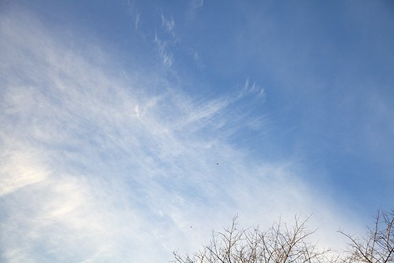
The first photo shows ragged looking Cumulus that were torn about by low level winds. These clouds moved on as drier air moved in the from the northwest. Later in the day, Cirrus running ahead of the next storm system were already moving overhead from the west. The final three photos are the namesake for these high clouds. Cirrus are wispy hairlike clouds and these photos show that. The bottom photo is dramatic as ice crystals form along a line and delicately trail back to the right.

Stratocumulus

Cirrus

Cirrus and Cirrostratus with a few Cirrocumulus

Unusual Example of How Cirrus Got Its Name. Note the line where the cloud is forming on the left and streaming away like flowing hair in the wind.
Text to be added.


Wide View

Close-up
Text to be added.

Wide View

Close-up

Wide View

Close-up
Moist relatively warm air flowing over deep snow cover often leads to the formation of dense fog. On this night visibility was reduced to less than 1/4 of a mile. The temperature of the air was in the 40s but the snow cover was near freezing and with dew points in the upper 30s fog developed. The dew point is the temperature when the relative humidity were reach 100%. As the air temperature is cooled to near the dew point by the deep snow cover fog begins to form. If temperatures fall below freezing ice from the fog in contact with sidewalks, streets, and highways can become ice cover if not treated with salt or other ice melt.

Text to be added.


Text to be added.


Text to be added.

Text to be added.

Text to be added.


Text to be added.

Text to be added.


Text to be added.


Copyright 2016-2024, Weather Briefing, L.C.
Cedar Falls, IA 50613, Phone: 319-215-2634, Email: craig@weatherbriefing.com

