

Clouds of the Day - Altocumulus waves - Friday, March 1, 2024
/When the wind blows the air can be turbulent or smooth. Air near the ground is often turbulent because of the contact of the air with the ground, including trees, buildings, hills and mountains. Also, layers of air with significant differences in density due to temperature and moisture differences, cause the air to develop waves (turbulence).
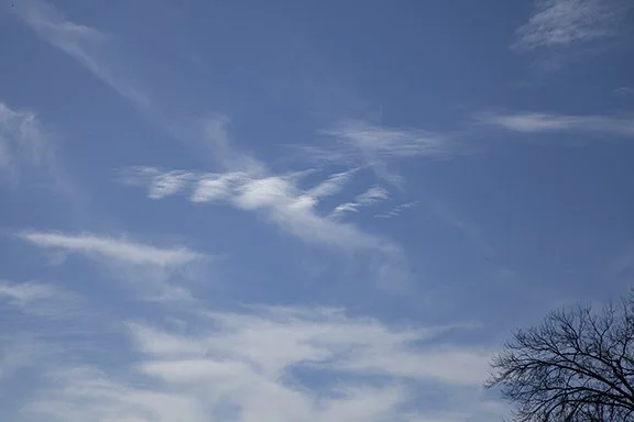
Clouds in the photos below clearly show waves. The air flow along boundaries between layers of different air density is setting the layers into up and down motion like waves in the ocean or on a lake. Cloud elements are condensing at the top of the waves with blue sky at the bottom of the waves. Waves are invisible in dry air because of the lack of clouds.

Altocumulus in the center with wave action.
Close-up of the waves shown in the photo to the left.

Waves all over the place. Notice the different sizes and spacing between the crests and valleys of the waves. The waves will be occurring in the blue sky.

We often see altocumulus with waves embedded within Altostratus clouds. The alto stratus is caused by very gentle upward mot ion over a broad area. That indicates a stable air mass. The altocumulus here is due to the undulating waves occurring in a stable layer. Note how the waves are distinctive even in a layer that also is producing a smooth flow. The flow ripples along with the general flow.