

Clouds of the Day - Cirrus uncinus - Wednesday, April 17, 2024
/Text to be added.

Close-up of Cirrus uncinus - These hook shaped clouds occur when ice crystals fall into slower moving air below the higher cloud head.

Medium view of the hook-shaped Cirrus uncinus located across the center of the photo.

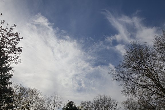
The widest view of the same area of sky. Most of the Cirrus uncinus are found near the bottom of the photo. The Cirrus in the top half of the photo are mostly Cirrus vertebratus because they look like a spine with cloud filaments extending perpendicular away from the main cloud. In the middle are Cirrus floccus that look like clumps of wool.
Most of the cloud visible in this photo is what is left of wind-blown cumulus. Wind gusts were blowing the weak updrafts of Cumulus around tearing the cumulus apart. There are altostratus on the left side of the photo.

There is wind blown cumulus in the foreground with Cirrostratus in the background (right sight) and Cirrus patches (top center and left).