

Thunderstorm Threat Growing
/The threat of thunderstorms with heavy rain and severe weather is growing for the middle of the U.S. As mentioned here on Saturday (June 18th) a large dome of warm air aloft and the main upper level flow steering around it is expected to flatten early this week and allow thunderstorms to return to the Upper Midwest. This afternoon temperatures have been in the 90s over most of Kansas with readings reaching at least 100 at Salina and Manhattan. These storms are occurring near a boundary between the hot air occupying the Desert Southwest and Southern Plains with cooler air to the northeast. As the flow aloft is pushed to the northeast once again more storms are expected along the nose of the hot air from the Dakotas, Nebraska, Minnesota, Iowa, and Missouri along with parts of Wisconsin and Illinois. As the pattern shifts northeast Tuesday and Wednesday the storm cells will likely move from northwest to southeast being fed by a southerly flow at the surface bringing moisture north underneath a west to northwest flow aloft. Storms in this scenario favor the afternoon through nighttime hours before ending after daylight.
Below are satellite and radar images from late this afternoon showing storm clusters in Iowa and Missouri.
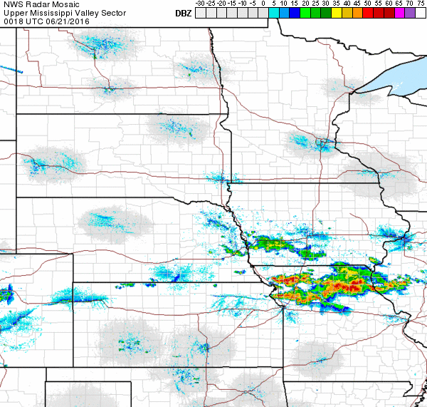
Radar Image from the National Weather Service at 7:18 p.m. CDT, 20 June 2016
Strong thunderstorms are shown on this satellite image in northern Missouri and also over Indiana. Smaller cells are in southern Nebraska. Thunderstorms are also indicated over southwest Iowa. More of the same is expected the next few days as the pattern shifts to the northeast. Check your local forecast for details.

GOES Visible Satellite Image at 6:45 CDT