

Thunder on the Plains
/Three areas of thunderstorms developed this afternoon over eastern Montana, eastern Wyoming, and eastern Colorado. As of 6:45 p.m. CDT the storms extended from western North Dakota to western Nebraska and are moving eastward. Tornado and Severe Thunderstorm Watches are strung out along the entire length of the thunderstorm clusters along with numerous Severe Thunderstorm and Tornado Warnings.
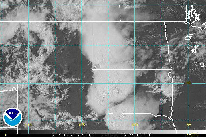
The storm clusters are visible on this GOES visible satellite imagery at 6:15 p.m., July 6, 2016. The storm tops are visible as dense circular cloud masses. The storms will continue moving eastward and will likely merge into a large thunderstorm complex with its core over South Dakota and northern Nebraska. The storms should move east before turning slightly southeast over northern into central Iowa overnight. Other storms should continue across much of Minnesota. Damaging winds, hail, and heavy rain will be likely with the main storm complex and tornadoes are also possible as the cells organize before the system evolves into a more outflow dominated system as it crosses central and eastern portions of Iowa. Small leading edge tornadoes could occur as the system moves east-southeast. For the lasted forecast check the National Weather Service at www.weather.gov and the Storm Prediction Center and your local news media. This site isproviding a general discussion about the storms but not regular updates.