

A Near Hit
/Close only counts in horseshoes. However, being close in the weather does have its advantages. For one, being close often avoids high winds and hail while still putting on quite a show.
Last evening a line of thunderstorms erupted south and southwest of Cedar Falls. Severe thunderstorm warnings were issued along the leading edge of the line. We were behind looking "in." Overhead were mammatus, the upside down lumpy clouds identified often with strong thunderstorms. (Keep in mind that storms with mammatus are not always severe and usually by the time they appear the threat is over.) In this case the threat was south and ongoing but where we were it was a pleasant evening.
The first photo below is looking east, the second is looking south, and the third is straight up. Notice how the appearance changes depending on where one looks. While the overall processes are similar across the sky each area had slightly different flow and processes occurring. Regardles, it was quite a show - all for free and all educational. The next step is wondering why!
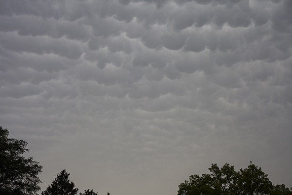
Photo Copyright 2018 by Craig Johnson/Weather Briefing, LC

Photo Copyright 2018 by Craig Johnson/Weather Briefing, LC

Photo Copyright 2018 by Craig Johnson/Weather Briefing, LC