

Thunderstorm Footprints on a Barograph
/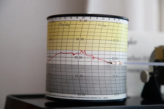
This is a great example of what happens to barometric pressure during the passage of thunderstorms. During the evening and night of Thursday, May 23rd into Friday morning May 24th several thunderstorms passed our location. Notice the unsteady pressure trace on the barograph beginning around 9:00 p.m. on the 23rd through 8:00 a.m. on the 24th. The pressure falls abruptly before a thunderstorm and rises quickly as the cooler down rush of air reaches and passes the barograph.
Typically the greater the fall-rise couplet the stronger the thunderstorm. Prior to and after the thunderstorms the pressure trace represented the pressure changes associated with the larger scale weather system affecting our area. The smaller scale changes are more dramatic and are superimposed on the larger scale changes.