500 Millibar Level (approximately 18,000 feet)

500 Millibar Level (approximately 18,000 feet)

To most people this chart looks something like a bowl of spaghetti. At first glance the squiggly lines seem to wander all over the place, making little sense. Meteorologists call this the 500 millibar chart. Instead of plotting weather data such as temperature, wind, and moisture at a specified altitude it is plotted at a specified pressure - 500 millibars. The 500 millibar pressure reading is higher in some locations and lower in other. It just so happens that at 500 millibars half of the mass of the atmosphere is above 500 millibars and half is below it. Its altitude is roughly at 18,000 feet.

Pressure maps are similar to a topographical map that we use to show variations in the altitude of land. The highest points on the map above (marked by an "H") are like mountains - the 500 millibar pressure is found at a higher altitude than at the low points which are marked by an "L". The solid lines in between the Hs and Ls are the same as lines on a topographical map. Just like on a topographical map, the closer the lines are together the steeper the slope. The farther they are apart the flatter the terrain. In our case the winds are stronger where the lines are close together.

On this chart you are looking down over the North Pole. The flow at 500 millibars is meandering from west to east around the pole. This west to east flow is found generally north of 25 to 30 N latitude. As the flow dips southward cold air is flowing away from the polar areas. Where it turns back to the north warm air is moving away from the topics. This process is part of the Earth's natural temperature regulation.

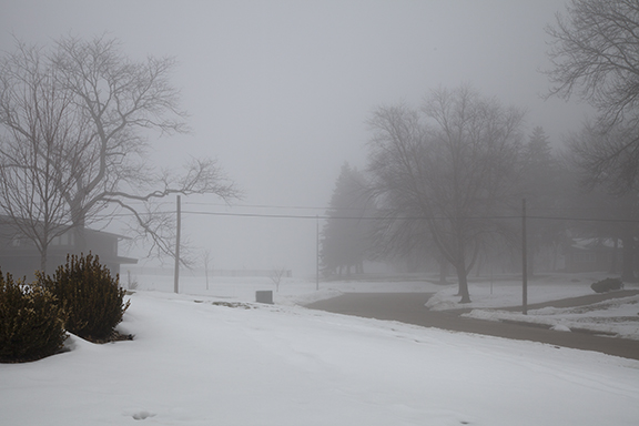
Notice the dip southeastward in the flow from western Canada to the Upper Midwest. This is a new push of colder air headed toward the Upper Midwest. Areas of snow and blowing snow expected to cause blizzard or near blizzard conditions and drop temperatures considerably.  See www.weather.gov for more information on the latest forecast.

The winds aloft are strongest where the lines are closest together. When the lines are close together it is call a tight gradient. Where the lines are far  apart it is a weak gradient and winds are weak. It is the general west to east flow that brings periods of stormy and calm weather. It is the ever-changing flow that determines what the next few days will be like. More about that in another post.


Snow Bands

Moderate to heavy snow has been falling in Cedar Falls this morning. It was been literally pouring snow due to the convection embedded in the precipitation. So far I have heard one crack of thunder (see post below). The radar image above is showing the precipitation intensity. The green areas are the heaviest bands of snow and are quite likely associated with the convection. The heavier snow bands are producing snowfall rates of up to 3 inches per hour. 

Heavy Snow and Thunder

There was thunder this morning. Yes it can thunder in winter. While thunder is more common the warm months it does occasionally happen during the winter. It isn't the temperature that matters, it is the difference in temperature. If the atmosphere is unstable due to warmer moist air rising through a cooler air column it doesn't matter whether the warm air is 32 degrees or 82 degrees. As long as the difference between the warmer and cooler air is sufficient to create a vigorous column of rising air and there is enough ice and water in the storm - lightning is possible. Where there is lightning there is thunder. Instead of pouring rain it was pouring snow!


Fog before the Storm

Yesterday (Monday) morning began with fog. Daytime temperatures have been in the upper 30s and 40s during the past couple of days which melted a considerable amount of snow. The weak upper level system that brought clouds and some light precipitation to Iowa Saturday night and Sunday moved east late Sunday clearing the skies. Clear skies, nearly calm winds, and low level moisture from the melting snow was a perfect set up for fog. The fog hung on until winds began to pick up ahead of the large winter storm that has now reached Iowa.  

The first photo shows the effect of diminishing visibility as we look north. Note the clearly visible bushes in the foreground and how objects in the distance grow dimmer as light reflected off the trees, homes, and a fence on the hilltop is filtered by the small droplets in the fog.

The photo below enhances the effect. The flag pole in the foreground is distinctly visible but the successive objects fade into the distance as the fog cuts down on the light reaching the camera from the decorative fencing and trees in the distance. The visibility was down to 1/4 of a mile in some locations. 

Still Waiting

A large winter storm crossing the West Coast is expected to move eastward through the Rockies into the central U.S. during the next 24 to 48 hours. When the earliest European settlers arrived in Iowa in the 1830s they did not have the luxury of knowing if the weather was going to change. Like the natives they learned to watch the sky, notice the wind, and use weather lore for hints of change. Sometimes the severity of the changes would elude them until it was too late. Today is a great example. Today the weather is very innocent. Clouds have covered the sky much of the day but there is certainly no hint of a big snowstorm on the horizon that would bring great hardship and perhaps death to the unknowing traveler. Temperatures are in the upper 30s and 40s. 

The National Weather Service surface weather map shows the associated weather with the western storm. It also shows a generally dry pattern over the central U.S: "The calm before the storm."

Widespread snow is expected through out the west particularly over the mountains and plateau. You can learn the details of local forecasts at www.weather.gov.

Upper level winds at 500 millibars (approximately 18,000 feet) show the upper trough crossing the west coast at 6 a.m. this morning. The trough is the core of cold air aloft. This storm is the real deal as we shall see once it reaches the Plains and feasts on moisture from the Gulf of Mexico.

500 millibar chart courtesy of the National Center for Environmental Prediction. Deep trough is digging southeastward along the west coast.

500 millibar chart courtesy of the National Center for Environmental Prediction. Deep trough is digging southeastward along the west coast.

The map also shows a weak upper level system crossing the Upper Midwest. This system spread light precipitation in the form of rain and snow from Colorado to the Upper Midwest from Saturday into Sunday. The photo below looking north from Cedar Falls, Iowa this afternoon shows the back edge of an altocumulus cloud layer associated with this weak system.

Looking north in Cedar Falls, Iowa at 4:00 p.m. CST. Clearing skies behind weak trough crossing Iowa.

Looking north in Cedar Falls, Iowa at 4:00 p.m. CST. Clearing skies behind weak trough crossing Iowa.

It is interesting to compare the upper air soundings (radiosonde or RAOBs) from Omaha and North Platte, NE this morning. Clouds and precipitation aloft formed ahead of the weak system moving into the Midwest where the air is rising. The RAOB from Omaha shows the moisture in the mid-levels between 800 and 700 millibars, which is a layer between 4,000 to 10,000 feet. Notice how the green dew point line moves closer to the red temperature plot on the chart below. Where the dew point and temperature are close together the relative humidity is high. This marks the area of cloudiness above and east of Omaha this morning.

Radiosonde sounding from NWS at Omaha Valley, NE. Relative Humidity is high where red (temperature) and Green (Dew Point) lines meet.

Radiosonde sounding from NWS at Omaha Valley, NE. Relative Humidity is high where red (temperature) and Green (Dew Point) lines meet.

The next sounding is from North Platte. Notice the atmosphere is drier at same level we looked at over Omaha. The spread between the dew point (green) and temperature (red) is much larger. This is a layer of dry air moving east over Nebraska in an area of downward motion behind the week trough over Iowa and eastern Nebraska. As this dry air moved east today it brought decreasing cloudiness to Iowa allowing the Sun to shine in some places behind the trough.

North Platte sounding shows dry air from just above the surface to about 600 millibars (approximately 13,000 feet).

North Platte sounding shows dry air from just above the surface to about 600 millibars (approximately 13,000 feet).

So what's next? We will watch the western storm move eastward. We expect a surface low to develop east of the Rockies over the Southern Plains before it turns northeastward. A Blizzard Watch covers much of western and northern Iowa into Eastern Nebraska. Around it are Winter Storm Warnings and to the southwest are Blizzard Warnings and Winter Storm Warnings. See the latest at www.weather.gov.

Here is a rather innocent picture looking southeast from Cedar Falls this afternoon. Altocumulus clouds dominate the sky as a weak upper trough moves eastward overhead. We are in the "calm before the storm." I will use this and the previous images as a comparison, before and after the storm. If all goes as planned these scenes will look much different in a couple of days. The difference between now and the mid-1800s is that we know about these storms well in advance. Early settlers and natives did not have that luxury and people paid the ultimate price.

Looking southeast at about 4:00 p.m. CST. Altocumulus cloud deck is moving to the southeast. 

Educational hint: Go back to our homepage and scroll down the page until you find the weather code downloads. In the materials available you will find a chart showing all of the weather plotting codes. The wind plots show how to read the wind direction and speed from station model plots. Use the explanation on the chart to read the wind barbs on the upper air map above.

Calm Before the Storm

"The calm before the storm." It's a period of quiet weather that sometimes precedes major storms. The air is nearly calm, the sky has an innocent look, betraying what is about to happen. But there is a reason for it. Quite often large scale vertical air motions are downward ahead of major storm systems. What goes up must come down. Large storm systems feature vast regions of rising motion. Rising motion, with sufficient moisture, causes the air to cool to its condensation temperature and develops clouds and eventually precipitation. Around the storm there must be compensating areas of downward motion - areas where clouds dissipate or do not appear threatening. It is the calm before the storm.

Here are three photos taken early this afternoon in Cedar Falls, Iowa. The first looks south, the second southwest, and the third west. The south and southwestern views feature altocumulus and cirrus clouds. Altocumulus are middle level clouds and the cirrus are higher. No precipitation falls from altocumulus. Cirrus often has fall streaks, downward streamers of ice crystals that do not reach the ground. It is why cirrus often look wispy. The west view shows cirrus obscured by falling ice crystals. The photo is looking almost straight up into the cloud layer.  The fall streaks are falling directly toward the camera causing an indistinct cloud base. 

A plume of moisture in a relatively milder west to east flow aloft is responsible. Areas of weak upward motion creates the altocumulus and cirrus. This is the leading edge of a band of weak upward motion well in advance of a major storm centered off the West Coast. That storm should reach Iowa by late Monday with a big dose of winter weather due to continue into Wednesday. So today is the, "calm before the storm." Sunday and Monday our weather gradually gets more complicated.

Altocumulus (top right), altostratus (bottom), and cirrus (middle) south 30Jan2016, 12:30 p.m. cst

Altocumulus (top right), altostratus (bottom), and cirrus (middle) south 30Jan2016, 12:30 p.m. cst

altocumulus SW 30Jan2016 12:30 pm cst

altocumulus SW 30Jan2016 12:30 pm cst

altocumulus (left) and Cirrus fall streaks, west, 12:30 p.m. cst

altocumulus (left) and Cirrus fall streaks, west, 12:30 p.m. cst