Clouds of the Day - May 6, 2020
/From cirrostratus to cumulus - from sunshine to overcast

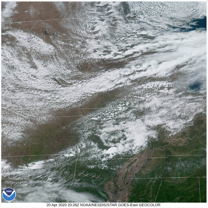
Photo is courtesy of NOAA.
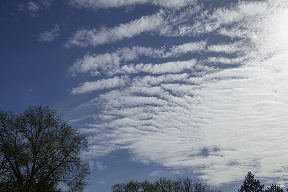
The upper left photo below shows cirrostratus clouds which are visible in the GOES 16 satellite image above. The cirrostratus is located over east central Iowa. They appear as wispy clouds with north-south banding and do not obscure the ground below. Cumulus clouds cover most of the remainder of Iowa. As you see below cumulus developed over the Cedar Falls/Waterloo area of northeast Iowa during the day. The photos are placed in chronological order.
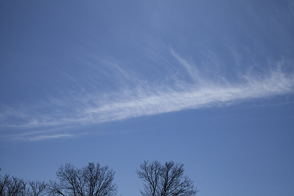
The day started with cirrostratus, one of ten principal cloud types. Cirrostratus often appear as a thin veil, whitish in color, with fibrous lines or a smooth texture. Both texture types are represented in the photos below. Cirrostratus are famous for producing haloes around the Sun or Moon. Ice crystals settling in the clouds bend (refract) sunlight to create the haloes. These clouds are found above 18,000 feet where temperatures are below freezing. Cirrostratus can be found in patches but if they spread over the entire sky and gradually thicken be on the look out for an approaching storm system. They spread out in advance of significant low pressure systems and were a warning to weather wise inhabitants of the plains. If the veil of cirrostratus becomes opaque, blocking the disk of the Sun from being visible, the cloud has transitioned to thicker and lower altostratus.

Cirrostratus

Small cumulus in foreground with Cirrostratus in background
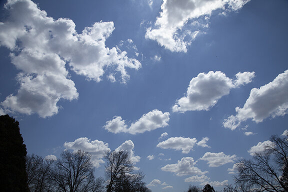
Before noon another principal cloud type began to form - cumulus (top right). The first stage of cumulus is cumulus humilus which is a small humble cloud. If cumulus remain as humilus they are nicknamed fair weather cumulus. Today the cumulus continued to grow into cumulus mediocris (a mediocre or medium size puffy cloud) and then on to cumulus congestus (larger and congested looking). Congestus is the last stage before precipitation begins to fall from the cloud. The next stage would be cumulonimbus, a large cumulus cloud producing rain or virga (rain not reaching the ground).
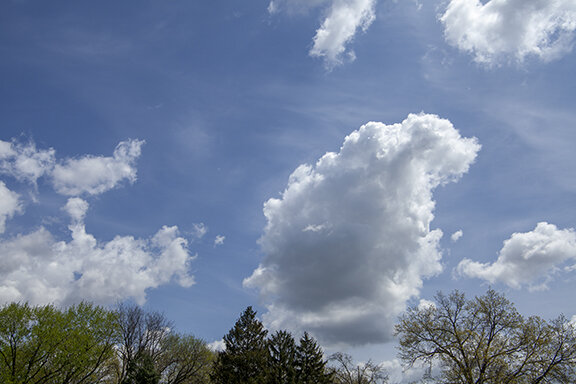
Cumulus mediocris (mediocre, Medium) with cirrostratus in background

Cumulus Mediocris in foreground with Cirrus and cirrostratus in background

Looking at the bases of cumulus clouds

Cumulus humilus (humble/small)
Suddenly, the sky turned threatening. Instead of blue sky punctuated by cumulus, the cumulus swelled into cumulus congestus. Then, just as suddenly, the cumulus flattened as updrafts lost their upward impetus. The clouds spread out and flattened, blotting out the Sun. The flattening of the cumulus occurred toward evening. By late afternoon the Sun begins losing its ability to heat the earth. As temperatures cool updrafts weaken. The cumulus flatten and spread over the sky further blocking the Sun. Any threat of showers comes to an end.

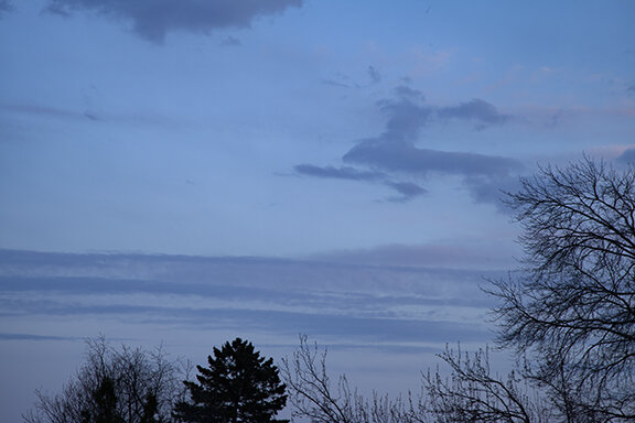
Cumulus, Cumulus congestus, Altocumulus

Altocumulus, altostratus
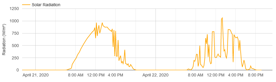
The solar radiation profile for today is on the far right of the chart below. Notice how the trace increases as the Sun climbs in the sky. It reaches its highest point at local Noon - today at 1:31 p.m. CDT. By the way, local Noon will occur later each day until the summer solstice occurs in June.
Compare the cloud photos today with the solar profile. Instead of a smooth increase in radiation there were small increases and decreases due to cloud cover. 1:31 p.m. would be the time of the peak radiation - except for the cloud cover. Notice the first large drop in radiation and its sudden recovery. That was followed by another large drop that was permanent. That’s when the Sun became completely covered for the remainder of the day. Clouds filled the sky, dropping the radiation from 1,000 watts per square meter to less than 500 watts and then 250 watts. Compare the chart with the photos to see how the cloud cover changed and how it affected the solar radiation reaching the ground.