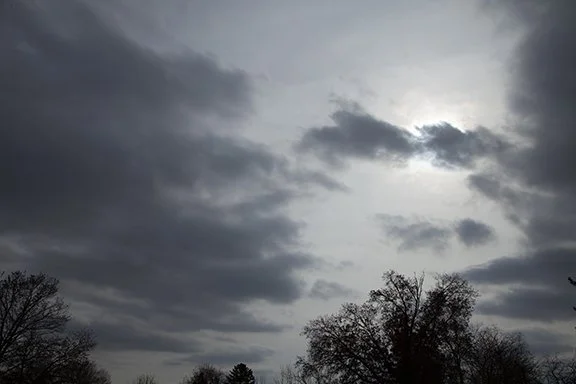
Winter Flocking - Hoar Frost
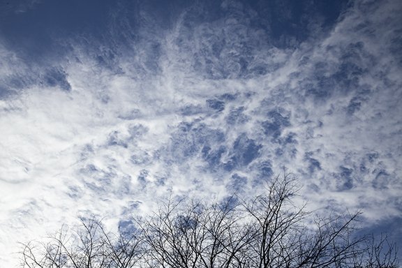
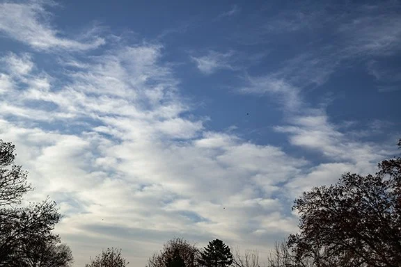
The combination of dense fog and sub-freezing temperatures is usually a good set-up for the formation of hoarfrost on trees and power lines. Hoarfrost is also known as white frost, crystalline frost, or just plain frost. It forms by sublimation which is the process where water vapor condenses as ice crystals. The trees in the photos below illustrate its beauty, especially with a blue sky background. Small diameter objects are ideal locations for the crystals to accumulate. Both the air and the objects must be below freezing. Cirrus and the spreading out of CONTRAILS (condensation trails) from aircraft formed the clouds in the background.

Winter Sky and Flocked Trees

Each of these photos feature Stratus clouds and trees decorated with newly fallen snow. Stratus are often featureless clouds with smooth bases that form during an invasion of colder air. These stratus formed near the top of a moist layer of air aloft in a region of upward motion. The upward motion developed in a northwesterly flow of air with broad cyclonic circulation over the Upper Midwest after a snowstorm.

Watch the sky change in 6 hours

Here is a sequence of photos that began in mid-morning and ended a couple of hours before sunset. The overcast at the end of the day was a layer of Altostratus clouds ahead of a weak upper level system aloft approaching from the northwest. The progression of lowering cloud ceilings (cloud bases) is caused by increasing moisture in the middle levels being lifted by the upward motion ahead of the weak storm system. The lifting raises the moisture to higher levels where the air pressure is lower. The moisture condenses into clouds which lower as the moist layer deepens and rising motion intensifies the condensation coverage.

Several clouds in the Cirrus family are seen in the top half of this photo. In the lower half a lower layer of altostratus is evident with small altocumulus.

Wispy Cirrus fibratus, Cirrostratus and high thicker Altostratus are seen in this photo. Fibratus means the cloud appears as filaments while cirrostratus are a thin smooth layer. The prominent cloud in the lower center has Cirrostratus and Cirrus fibratus characteristics. While we like to apply specific names to clouds nature forms clouds that may appear as combinations of cloud types. We normally look for what is most dominant or include all of the types in our descriptions if they are significant. Either way, the different types occur because different cloud processes and motions are creating the different shapes, sizes and cloud textures.

Compare this photo to the one below. The clouds look like waves washing up on a beach after the top of the wave broke. linear Thicker clouds alternate with thinner bands of cloud and blue sky. In The photo below small drifts resemble the wavy clouds. The waves are in bands determined by variations in wind speed that align perpendicular to the camera. Turbulent wind is crossing the snow in waves which deposit the ripples on the snow surface.

Drifted snow mimics wave patterns that are seen in clouds.

Here is another view of the wave forms in the clouds above. Notice the numerous CONTRAILS (Condensation Trails) as water vapor in the engine exhaust of aircraft condenses in the cloud streaks. In the upper left there is a shadow cast by the sun shining on a CONTRAIL. These clouds look like Cirrostratus and Cirrus fibratus. There is a patch of Cirrocumulus in the lower center and a band of thicker cirrostratus which look suspiciously like it could have began as a CONTRAIL.

This is altostratus with an indistinct cloud base. Look at the cloud base in the lower part of this photo and you will see the cloud base hanging as a thinning cloud bottom that gives way to a whiter sky near the horizon.

This is an Altostratus cloud that is transparent to the sun. There are two layers. The sunlight is diffused by the higher layer and the lower layer appears to be another altostratus layer (above 6,500 ft) but may have invaded the lower layer (below 6,500 ft) which would make it a stratus cloud. As the layer of upward vertical motion and moisture deepens with the approaching storm the cloud depth thickens. Eventually the upper and lower cloud layers merge as precipitation forms and the cloud name changes to Nimbostratus. Nimbostratus is a precipitating cloud. When precipitation stops the cloud with either be labelled stratus (a low cloud below 6,500 ft) or altostratus if its base is above 6,500 feet.

Dull Gray Sky

My least favorite clouds are featureless Stratus with diffuse cloud bases. Low level moisture in a northwesterly flow of air that is moving in behind low pressure centered near the Great Lakes is gently rising in the stable air. The result is a low cloud deck several hundred feet above the ground. True Stratus might produce a little drizzle but that is about it. Otherwise the most we can hope for will be clearing skies and bright sunshine before the day is over.

48 Hours Before a Snowstorm

Before the time of satellite imagery and computer weather forecast models an observer looking at this sunset could only guess if there was a storm over the horizon.

This photo looks to the southwest toward Cirrus, Altostratus and Altocumulus clouds. As luck would have it these clouds were detached from the real storm that would approach from the northwest in 48 hours. These clouds were associated with ‘warmer’ air aloft moving our way from the Southern Plains. The air was being lifted enough to condense its water vapor into tiny water droplets and ice crystals.

The sky does provide hints of what is to come if you know what to look for. The more you know about what is happening the more hints clouds can provide. Having a barometer to watch air pressure rise, fall, or remain steady is helpful. If pressure is changing quickly a change is more imminent. Noting the wind direction and speed and how they are changing helps forecast what is on the way. Your forecasts won’t be perfect but learning about the wind, air pressure, and clouds opens the door to being more weather wise!

In this case we ended up with 4 inches of snow.

Bird in flight: IFR to VFR

A lone bird is caught in flight headed west on a cold December morning. Northwest winds were scouring out morning fog and the remnants of the fog was now on the verge of forming Cumulus clouds. Just a couple of of hours earlier dense fog shrouded the landscape. In aviation terminology pilots had to follow Instrument Flight Rules (IFR). As the fog dissipated conditions improved to VFR (Visual Flight Rules). We don’t see many birds flying during episodes of dense fog. On this morning temperatures were in the teens as drier air mixed out the moist air and dissipated the fog and birds once again took to the air.

Orion Constellation

This hand held photo of the constellation Orion was taken about an hour after the Moon ended its occultation of the planet Mars on the evening of December 7th (2022). Orion’s nearly vertical belt is plainly visible just right of center between the Altocumulus wave type clouds. A thin streak of light is visible just to the right of the wave cloud farthest to the lower left. It is likely from an aircraft flying toward the east.

These altocumulus have formed in a mid-level layer of moist air where wavy air motion reaches a peak. The flow is right to left. The clear sky between the clouds occurs where the waves are sinking. The alternation rising and sinking air creates a series of clouds and clear strips.

Photo copyright 2022 by Craig Johnson, Weather Briefing, LC

A Day of Cirrostratus

All of the photos from today were taken at the same time from the same location. The camera was just pointed in different directions. Viewing the sky can be a pleasant past time and may generate many questions about why and clouds form and what causes the different shapes.

The photos from today reveal classic Cirrostratus clouds. Cirrostratus indicate the saturation of a broad layer of the atmosphere. The cloud layer is very thin and the ice crystals only dim the sunlight. This photo and the one about it were taken about a minute apart. Notice the difference in the position of the jet CONTRAIL between the photos.

Cirrostratus with a CONTRAIL

Cirrus fibratus and cirrostratus

The photo above features long thin strands of ice crystals blown by strong steady high winds aloft. The clouds were stretched across a wide area of the sky with an even texture because of the steady winds. As with all Cirrostratus, these clouds dimmed the sunlight but did not block it.

Cirrus, cirrostratus, cirrus fibratus, a CONTRAIL (Condensation Trail)

Here is more Cirrostratus in the form of sheets and filaments. The CONTRAIL is long and distinct indicated the layer were it is flying is moist, which slows the sublimation of the ice crystals. Sublimation occurs when ice changes directly to water vapor without first melting into a liquid. Water changes from water droplets to a vapor by evaporation.

One more look at the Cirrus sheet shows Cirrostratus and Cirrus fibratus.

Picturesque Cirrus fibratus and Cirrus uncinus

Cirrus fibratus (thin fibers in bands) and Cirrus uncinus (hooked cirrus) covered the southern sky early this afternoon. This photo is looking south from Cedar Falls, Iowa.

One explanation for the formation of Cirrus uncinus indicates that a region of rising air forms the ‘head’ of the cloud while the tail forms when ice crystals precipitation out of the head and fall into slower moving air below the head. The heads appear to be at the highest point and leading end of the cloud where the formation is dense with falling ice crystals. As the crystals fall they trail behind the head because the air below is moving slower.

The leading edge of the cirrus looked like long thin fibers.

Snow Squalls Riding Northerly Winds

Sunrise with stratocumulus and snow flurries. The same air mass that was bringing heavy snow squalls to the lee shores of the Great Lakes brought flurries and light snow to portions of the Upper Midwest. Temperatures were in the lower teens at dawn.

These Stratocumulus were producing snow showers with light accumulations. Most Stratocumulus do not precipitate but if they do it us usually drizzle. In a cold atmosphere with low level moisture we can get quick bursts of mainly snow flurries.

Snow showers are occuring with this cumulus cloud. The streamers can be seen hanging below the cloud and looking lower the white ‘hazy’ sky is snow falling in the cold atmosphere with temperatures in the teens.

More falling snow is visible below the white cloud tops in this photo.

Geese on the ‘run.’

A flock of Canadian Geese is headed west toward a wetland on the west side of Cedar Falls. The Sun was rising in the southeast this morning and its light was being filtered by a low deck of Stratus cloud. Low level cold air cut underneath a Pacific Air Mass aloft creating the stable stratus cloud layer. Temperatures were in the upper 20s.

Photo Copyright by Craig Johnson, Weather Briefing, LC, 16 November 2022, Cedar FAlls, Iowa.

Looking southeast toward the sunrise we see a bright diffuse solar disk on the rise. The light is diffused by the shallow cloud layer giving the Sun a frosted glass appearance.

Photo Copyright by Craig Johnson, Weather Briefing, LC, 16 November 2022, Cedar FAlls, Iowa.

There was blue sky too. As colder drier air moved in the Stratus was broken into fragments allowing sunshine and areas of blue sky to appear. Temperatures responded lightly with readings touching 30 degrees during the day.

Photo Copyright by Craig Johnson, Weather Briefing, LC, 16 November 2022, Cedar FAlls, Iowa.

Clouds of the Day: Altocumulus

Taken at 11:30 this morning these clouds looked cold. Temperatures in the 20s and no leaves on the trees added to the effect. The Sun was visible through the cloud deck, which revealed the cellular cloud pattern of Cumulus clouds.

‘Alto’ means high. This photo shows clouds above 6,000 feet (2,000 meters), which we refer to as the middle layer of the atmosphere. It is just above the lowest layer, which is near the surface. The lowest Cumulus cloud type is named Cumulus. However, because the clouds in this photo are just above the lowest layer, they are named Altocumulus (high cumulus). The higher cloud layer above these clouds is where ‘Cirrus’ clouds are found. Cumulus in that layer are called Cirrocumulus.

Iridescent Clouds and Irisation

Photo copyright by Craig Johnson in Cedar Falls, Iowa on November 8, 2022.

Iridescent clouds are clouds of ice-particles. They display brilliant spots or borders with red and green colors. The colors are seen 30 degrees or less from the Sun. The ice particles are very small and are nearly all of the same size. Irisation, which is the coloration seen at the cloud edges, are mostly red in this photo but there are hints of green tinges too. The clouds displaying the irisation are Altocumulus with a distinct pattern caused by wavy motion in the wind.

Winter Weather Precipitation

Winter is raising its head so here are a few definitions of winter precipitation types. The information is adapted from the Glossary of Meteorology published by the American Meteorological Society in 1959.

  • Snow is composed of white or translucent ice crystals, chiefly in complex branched hexagonal form and often agglomerated into snowflakes. In other words, snowflakes are made up of individual ice crystals stuck together in groups of many ice crystals. Snow that falls through a deep wet layer after forming may grow into large snowflakes while falling toward the ground. If snowflakes form and fall through a dry layer layer do not grow into large flakes. The shape of ice crystals is mostly determined by the temperatures at which they develop and grow.

  • Snow pellets, also called graupel or soft hail, are white, opaque ice particles approximately round or conical in shape. They form when super-cooled water collects on ice crystals or snowflakes. Super-cooled water water that is below freezing. Snow pellets usually bounce when they fall on a hard surface and often break into smaller pieces.

  • Snow grains are very small, white opaque particles of ice. They are the solid equivalent of drizzle. They resemble snow pellets in external appearance, but are more flattened and elongated, and generally have diameters of less than 1 millimeter; they neither shatter nor bounce when they hit a hard surface.

  • Ice pellets, or sleet, are small balls of ice that form from the freezing of raindrops or the refreezing of melting snowflakes when they fall through a layer of below-freezing air near the surface of the earth.

  • Freezing rain occurs when rain hits a surface with a temperature that is below freezing. As the drops fall through a layer of sub-freezing air near the earth’s surface, they become super-cooled, which means the drops are below freezing but are still liquid water. When the drops hit the surface, the splattering disturbs the liquid drops, causing them to freeze instantly. Freezing rain forms a dangerous coating of ice causing falls, broken bones, and automobile accidents.

Clouds of the Day for Friday, November 4, 2022 - Nimbostratus

Today was a rainy Friday. As of 8:45 p.m. the rain gauge recorded 1.23 inches of rain with light rain still falling. The photo below was taken this afternoon. It shows wet streets and if you look closely you might even see a few splashes of rain drops hitting the concrete.

The ground is wet from continuous rain. Looking skyward we see the dull gray sky of Nimbostratus clouds. Nimbus means rain and a Nimbostratus is a cloud with rain. Rain must be present without thunder or lightning for the cloud to be Nimbostratus. If thunder and lightning are present with rain the cloud is Cumulonimbus.

Nimbostratus usually have an indistinct cloud base below 6,000 feet which is obscured by rain. Nimbostratus may form in the middle levels as altostratus and then lower and evolve into Nimbostratus as rain begins to fall and moistens the lower level of the atmosphere. The cloud base lowers and gradually becomes obscured.

Finally let’s look at two charts. The first chart shows the thermograph of the past 48 hours. T his chart is plotting temperature, dew point, and relative humidity from left to right. We can see when the leading edge of the cold front passed just before 4:00 a.m today. Notice how the temperature trace (solid red line) suddenly begins dropping from near 60 degrees to the lower 40s by Noon. The dew point also began dropping with the passage of the front as drier low level air moved in from the west. The relative humidity began to rise (blue dashed line) as the temperature cooled and rain began around 8:00 a.m. The relative humidity increases when the temperature cools and the dew point remains about the same and it also increases when rain evaporates more moisture into the air as water vapor.

Finally, here is the trace from the rain gauge. The blue link shows the total rainfall with time and the purple line shows the rainfall rate with time in inchs/hour. At the end of the trace the total was 1.25 inches.

Clouds of the Day, Thursday, November 3, 2022: Here Comes the Rain

It has been bone dry over the Plains and much of the western United States. The chart below shows the extent of the dry conditions from the Plains States and across the southern and western United States.

U.S. Seasonal drought outlook is courtesy of NOAA.

The map below shows where precipitation is expected through Friday morning. The storm will spread eastward in to the weekend. Rain is falling on the east side of the storm with snow on the west side into the higher terrain of the Rockies.

Forecast chart is courtesy of NOAA/National Weather Service.

After many days of clear skies things are getting more active here. The following photos show the progression of clouds today. The first photo shows Cirrus in the upper right corner and a mix of Cirrus and Altostratus in the upper left. The lower half has Altocumulus and Altostratus clouds. The photo was taken around 8:30 this morning.

By early afternoon ragged Cumulus appeared as low level moisture appeared.

The dew point trace on the graph below is the green dotted line. Notice how the dew point temperature began to increase around 5:00 this morning and continued to increase in to the afternoon.

Temperature, Dew Point, and Relative Humidity Chart is from the Dyacon Weather Station here at Weather Briefing, LC, Cedar Falls, Iowa

The next photo shows Stratocumulus clouds this afternoon with a layer of Altostratus above with diffuse sunshine coming through the Altostratus. The dark bases of the Stratocumulus are caused by t he clouds being in the shadow of the Altostratus with the cloud bases receiving minimal sunshine. The Stratocumulus are forming as low level moisture from the Gulf of Mexico pushes the dew points into the 50s after being in the 30s for the past several days. The Altostratus are spreading in from the west above 8,000 feet with an increase in mid-level moisture.