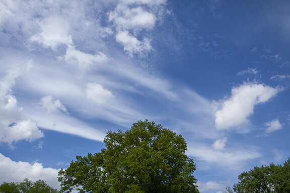
Clouds of the Day - Memorial Day Monday, 25 May, 2020

Today started with a stratocumulus overcast that by mid-morning broke into a day with bright sunshine and temperatures hitting the low 80s.

Stratocumulus

Stratocumulus

Stratocumulus transforming into cumulus

Stratocumulus transforming into cumulus

Cumulus

Cumulus

Cumulus

Cumulus

Cirrus with developing cumulus in the foreground

Cirrus with developing cumulus in the foreground

Altocumulus with thin cirrus above

Altocumulus with thin cirrus above

Cumulus mediocris

Cumulus mediocris

Cumulus mediocris

Cumulus mediocris

Cumulus congestus under an altocumulus layer

Cumulus congestus under an altocumulus layer

Cumulus congestus (lower center) with ragged altocumulus top of photo and altostratus layer (right center).

Cumulus congestus (lower center) with ragged altocumulus top of photo and altostratus layer (right center).

Cumulus congestus base

Cumulus congestus base

Low hanging ragged cumulus

Low hanging ragged cumulus

Cumulus congestus tower

Cumulus congestus tower

Clouds of the Day - Sunday, May 24, 2020

A large area of showers and thunderstorms moved out of Nebraska into western and central Iowa overnight and this morning. As the storms moved toward eastern Iowa they began to weaken. As the “leftovers” moved into the Cedar Falls area the activity was weakening. What remained is depicted in the photos below. A weak outflow boundary and showers crossed the area. The first two photos were along and under the outflow and the next two photos were looking east after the showers passed.

Approaching outflow boundary with low level arcus (squall) cloud.

Approaching outflow boundary with low level arcus (squall) cloud.

Under the arcus (squall) cloud looking southeast in direction the cloud is moving.

Under the arcus (squall) cloud looking southeast in direction the cloud is moving.

Here is the pressure trace. May 24th begins at the vertical line marked May 24, 2020. Notice the pressure jump at 9:00 a.m.; just past the 8:00 a.m. mark. As cooler outflow from the weakening thunderstorms to the west reached Cedar Falls the pressure increased. Notice the wind direction changed from easterly (100 degrees) to northwesterly (333 degrees) between 9:00 and 10:10 a.m.

CF_Pressure_Trace_Sunday_5-24-2020.PNG
CF_Wind_Direction_Sunday_5-24-2020.PNG

Light rain showers with thunder fell after the pressure jump and the wind shifted. Rain was light, totaling only .06 inches. The two photos below show clouds to the east as the rain departed.

Cumulus, cumulus mediocris, and cumulus congestus in foreground. Dark cloud band appearing to reach the ground just above the trees center-left is a rain shaft. Photo looking east northeast.

Cumulus, cumulus mediocris, and cumulus congestus in foreground. Dark cloud band appearing to reach the ground just above the trees center-left is a rain shaft. Photo looking east northeast.

Sun visible upper left through altostratus layer with ragged cumulus and cumulus congestus lower half of photo.

Sun visible upper left through altostratus layer with ragged cumulus and cumulus congestus lower half of photo.

2020_05_24_3992_Ac_4x6_96dpi.jpg
2020_05_24_3993_Cs_Ac_4x6_96dpi.jpg
2020_05_24_3995_As_4x6_96dpi.jpg

The photo above shows altostratus over the entire sky in two layers. The higher layer covers all but the very bottom of the photo where a lower and darker mid-level deck of altostratus is visible between the trees. There is small patch of altocumulus just left of the trees. The photo is looking slightly east of south.

Compare the photo with the radar image below. Cedar Falls, Iowa, where the photos are taken, is located just northwest of Waterloo, Iowa. Waterloo is on the map in the northeast quadrant of the map. The photo above is looking southerly toward the large area of showers and thunderstorms spreading north in Iowa. Looking at the photo it would be expected to see lowering cloud decks looking in the direction of the precipitation.

RAdarScope_0130Z_5-24-2020.PNG

Clouds of the Day - Tuesday, May 19, 2020

A departing upper low pressure continues to spin stratus overhead but there were some differences from the past couple of days. A few breaks in the overcast gave a fleeting view of blue sky. There also was a mixture of stratus and cumulus type clouds instead of just stratus.

Stratus, stratocumulus (dark low cloud lower center and right), and Altocumulus (upper left).

Stratus, stratocumulus (dark low cloud lower center and right), and Altocumulus (upper left).

Stratocumulus (left) and stratus (upper center to lower right).

Stratocumulus (left) and stratus (upper center to lower right).

Cumulus scattered through most of this photo with Stratocumulus in the upper right.

Cumulus scattered through most of this photo with Stratocumulus in the upper right.

Fragments of cumulus scattered across the photo with a small patch of stratus or altostratus just up and left of center.

Fragments of cumulus scattered across the photo with a small patch of stratus or altostratus just up and left of center.

Definite cumulus with stratus or altostratus upper right.

Definite cumulus with stratus or altostratus upper right.

Stratus

Stratus

Here is our morning weather map at 1600Z (11:00 a.m. CDT). Low overcast covers the Great Lakes and Ohio Valley west to eastern South Dakota,. Nebraska, and eastern Kansas. The low center is centered over northern Kentucky. The cloud photos above are taken from Cedar Falls, Iowa (northeast Iowa) where cloud ceilings have been less than 1,000 feet.

Practice your weather map reading skills by decoding the weather observations. To learn how use our website instructions found by clicking this link: https://www.weatherbriefing.com/observing-forms

Surface Map, Tuesday, May 19, 2020, 1600Z, Map Plotted using Digital Atmosphere, available at www.weathergraphics.com.

Surface Map, Tuesday, May 19, 2020, 1600Z, Map Plotted using Digital Atmosphere, available at www.weathergraphics.com.

Here is the GOES-16 visible satellite image at 11:31 CDT this morning. A large low pressure system centered over Kentucky is meandering slowly over the Ohio Valley and spilling clouds as far west as Nebraska. The clouds shown in the photos above are part of this storm system.

GOES 16 image, USA Visible Satellite Image, 1631Z (11:31 CDT) showing Low centered over Northern Kentucky with cloud shield covering eastern and central USA. Image Courtesy of NOAA.

GOES 16 image, USA Visible Satellite Image, 1631Z (11:31 CDT) showing Low centered over Northern Kentucky with cloud shield covering eastern and central USA. Image Courtesy of NOAA.

Clouds of the Day - Sunday, May 17, 2020

Today was a change from the past several days. Just scroll down to see the difference in cloud types compared with today. Today featured stratus, one of ten principal cloud types. Stratus is a gray cloud layer with a nearly uniform base and is in the low cloud family. Stratus is not a precipitation type cloud except it will occasionally produce drizzle when the relative humidity is very high from the cloud base to the surface. It can be found in patches or a sky covering sheet. Stratus can obscure the Sun or sometimes the disk of the Sun is visible.

Here are four pictures of stratus as it appeared today.

Stratus with drizzle

Stratus with drizzle

Stratus with drizzle

Stratus with drizzle

Evening stratus are no different that mid-day stratus but the Sun low in the west created this dramatic scene. It looked a little ominous but these stratus were harmless, like all other stratus. The lightning made the difference.

Evening stratus are no different that mid-day stratus but the Sun low in the west created this dramatic scene. It looked a little ominous but these stratus were harmless, like all other stratus. The lightning made the difference.

Stratus in the evening. The sky was overcast giving a look that was completely different that the picture to the left.

Stratus in the evening. The sky was overcast giving a look that was completely different that the picture to the left.

Clouds of the Day - Saturday, May 16, 2020

Cirrostratus

Cirrostratus

Cirrostratus low on the north horizon

Cirrostratus low on the north horizon

Cirrostratus covering nearly th entire sky. Contrail splitting the photo in two.

Cirrostratus covering nearly th entire sky. Contrail splitting the photo in two.

Cirrostratus covering the entire sky with halo arouind the Sun.

Cirrostratus covering the entire sky with halo arouind the Sun.

Altocumulus lenticularis dissipating.

Altocumulus lenticularis dissipating.

Several lens/saucer shaped clouds - Altocumulus lenticularis. The best examples of lenticularis

Several lens/saucer shaped clouds - Altocumulus lenticularis. The best examples of lenticularis

Cumulus clouds under Cirrostratus.

Cumulus clouds under Cirrostratus.

More cumulus under cirrostratus.

More cumulus under cirrostratus.

Sky full of cumulus.

Sky full of cumulus.

More cumulus in various stages of development covering the sky.

More cumulus in various stages of development covering the sky.

Clouds of the Day - Thursday, May 14, 2020

Stratus (drizzling at time of photo)

Stratus (drizzling at time of photo)

Stratus

Stratus

Stratus with fog visible

Stratus with fog visible

Altocumulus (center and left) altostratus with altocumulus in background

Altocumulus (center and left) altostratus with altocumulus in background

Altocumulus in cells (upper left) and waves/Altostratus (Lower right half), Fall streaks (lower left to upper right)

Altocumulus in cells (upper left) and waves/Altostratus (Lower right half), Fall streaks (lower left to upper right)

Altocumulus (top, left), fall streaks of ice crystals (center and right)

Altocumulus (top, left), fall streaks of ice crystals (center and right)

Altocumulus

Altocumulus

altostratus (lower left), cumulus (lower center to right), thin altostratus upper half)

altostratus (lower left), cumulus (lower center to right), thin altostratus upper half)

Clouds of the Day - Tuesday, May 12, 2020

Altocumulus is one of ten principal cloud types. It occurs in the mid-levels of the atmosphere between the altitudes of 6,500 to 20,000 feet. Altocumulus occurs in a layer or patches of wavy, round, rolling, laminated shapes. The individual cloud elements when viewed more than 30 degrees above the horizon subtend an angle of 1 to 5 degrees. They appear smaller than cumulus that form in the low levels. They are made of small liquid cloud droplets or ice crystals. Even when temperatures are below freezing liquid droplets often occur in these clouds. This is known as supercooled water.

Today the sky has various types of altocumulus on display. Many of the different types are represented in the photos below. You will see individual cloud cells, wavy clouds and combinations of both shapes. In the first five photos the clouds look soft and fluffy. After that the sky changed. It transitioned from cellular to wavy altocumulus and finally cirrus.

Altocumulus (cells and wavy)

Altocumulus (cells and wavy)

Altocumulus (cells and wavy)

Altocumulus (cells and wavy)

Altocumulus (cells and wavy)

Altocumulus (cells and wavy)

Altocumulus (cells and wavy)

Altocumulus (cells and wavy)

Altocumulus (cells and waves)

Altocumulus (cells and waves)

Altocumulus (waves and small cells)

Altocumulus (waves and small cells)

Altocumulus (waves and small cells)

Altocumulus (waves and small cells)

Altocumulus (cellular)

Altocumulus (cellular)

During the afternoon the sky changed character - from altocumulus to cirrus. Cirrus are high flying clouds above 18,000 feet. Made of ice crystals, cirrus paint spectacular formations over blue sky. An official definition describes cirrus as a ringlet or curling locks of air. The cirrus in the photos play that part well. The bottom photo is strange. This thin line of cirrus may be man made, possibly due to an aircraft. The line of cirrus was in the sky for over an hour and moved from the western sky to the eastern horizon.

Cirrus

Cirrus

Cirrus

Cirrus

Cirrus (man made?)

Cirrus (man made?)

Clouds of the Day- May 10, 2020

Map Plotted by Digital Atmosphere software available from http://www.weathergraphics.com/

Map Plotted by Digital Atmosphere software available from http://www.weathergraphics.com/

GOES 16 Satellite Image courtesy of NOAA. - 1416Z 5-10-2020.

GOES 16 Satellite Image courtesy of NOAA. - 1416Z 5-10-2020.

It’s a chilly Mother’s Day as cold air continues to spread south in to the central and northeastern United States. Here is today’s Clouds of the Day in Cedar Falls, Iowa. The cloud formations today are common during unseasonably cool outbreaks. The May sunshine To learn how to decode surface station model plots on the map above click HERE and scroll down.

Cumulus (lower left and bottom),  stratocumulus (lower left corner), Altocumulus (center to upper right)

Cumulus (lower left and bottom), stratocumulus (lower left corner), Altocumulus (center to upper right)

Cumulus and stratocumulus, Thin altocumulus (upper right)

Cumulus and stratocumulus, Thin altocumulus (upper right)

Cumulus and stratocumulus

Cumulus and stratocumulus

Stratocumulus (upper), altocumulus lenticularis (lens shaped)

Stratocumulus (upper), altocumulus lenticularis (lens shaped)

stratocumulus and cumulus

stratocumulus and cumulus

Base of Cumulus congestus that produced snow pellet shower at a surface temperature of 48 degrees.

Base of Cumulus congestus that produced snow pellet shower at a surface temperature of 48 degrees.

2020_05_10_3831_Cu_4x6_96dpi.jpg

More clouds and snow pellet showers approaching from the northwest. Rain and melted snow pellets equaled .03 inches.

Clouds of the Day - May 9, 2020

Altocumulus lenticularis form from waves in the air. Since they form in a stable layer the clouds do not have extensive vertical height. The often have a lens shape or have the profile of an ariplane wing. Look closely at these clouds and you will s…

Altocumulus lenticularis form from waves in the air. Since they form in a stable layer the clouds do not have extensive vertical height. The often have a lens shape or have the profile of an ariplane wing. Look closely at these clouds and you will see the lens/airplane wing shape in these clouds.

Above the altocumulus were cirrus. You will see the cirrus in the background of the altocumulus in today’s photos.

Above the altocumulus were cirrus. You will see the cirrus in the background of the altocumulus in today’s photos.

Cirrus and altocumulus lenticularairs

Cirrus and altocumulus lenticularairs

Cirrus and Altocumulus lenticularis

Cirrus and Altocumulus lenticularis

Cumulus

Cumulus

Cumulus and altocumulus

Cumulus and altocumulus

The clouds roll in frm the northwest. Cumulus and altocumulus

The clouds roll in frm the northwest. Cumulus and altocumulus

Altocumulus and cumulus

Altocumulus and cumulus

Frosty Night Ahead

Chilly high pressure is centered over Nebraska at mid-afternoon. The air is very dry with relative humidity around 30% or lower. Strong northerly winds and sinking motion ahead of the high pressure center are ushering very dry air across the Midwest.

If you would like to know how to decode the surface station model plots on the map go HERE on our website. Decoding the surface observations on the surface map below reveals current temperatures in the upper 40s and 50s in Minnesota, Iowa, Nebraska, and Wisconsin. Dew points are in the teens and low 20s. That with clear skies and diminishing winds will set the stage for frost and freezing temperatures east of the high pressure ridge from the Plains east to the Great Lakes, Ohio Valley and Mid-Atlantic States. See your local forecast at www.weather.gov.

SFC_USA_20Z_5-8-2020.PNG

Clouds of the Day - May 8, 2020

Clear skies ahead of a large high pressure area have produced beautiful blue skies today. The air is very dry which will lead to frost and freezing temperatures tonight. Our median last frost date here is May 4th. The blue sky is striking today. The blue is caused by the scattering of sunlight by our atmosphere. The solar spectrum contains all light colors we see. Because our atmosphere scatters more blue and violet light than other colors the sky looks blue. Without our atmosphere our sky would be black. To prove it just look at the second photo below.

Clear blue sky this morning

Clear blue sky this morning

Here is a photo taken from the Moon during the Apollo 11 mission, probably by astronaut Buzz Aldren. The photo shows black sky with Earth in the background during the lunar day. Because the Moon has no atmosphere sunlight is not scattered and the sky appears black - unlike Earth which has blue sky because of the scattering of sunlight. By the way, on average a lunar day lasts approximately 29.5 Earth days.

Apollo 11 photo probably taken by Buzz Aldren from the surface of the moon. Photo courtesy of NASA and found HERE

Apollo 11 photo probably taken by Buzz Aldren from the surface of the moon. Photo courtesy of NASA and found HERE

A few low clouds developed during the late morning and afternoon. The clouds were the result of weak updrafts during the heat of the day. Because the clouds were borderline puffy they are considered to be cumulus. Since they were weak with little vertical development we call them cumulus humilus - a humble cumulus.

All clouds fit into a High, Middle, or Low cloud family - based on their altitude. Cumulus are in the Low Family. The name is abbreviated Cu. Cumulus is one of ten principal cloud types. It forms as detached cloud elements which are usually dense with sharp distinct outlines. Cumulus have a vertical structure with rising heaps, towers or domes. Where the Sun shines on the cloud it is usually a bright white color. Its base and areas in shadow are dark.

See our cloud atlas for more information.

Cummulus

Cummulus

Cumulus

Cumulus

Today’s solar radiation chart (May 8th) shows where clouds temporarily blocked the Sun. The greatest decrease in radiation occurred as a dense cloud passed over the Sun. Other less dense clouds made only small changes in the amount of radiation reaching the sensor. When using sunlight for the generation of electricity it is clear that large changes in voltage can occur over very short time periods. The trace from late morning on the 7th shows that cloud cover was not only variable over the short term but in general the amount of generation would be much lower throughout the day compared to today.

Solar_Radiation_5-8-20.PNG

Clouds of the Day - May 7, 2020

Today dawned with thin altostratus/altocumulus overhead but quickly turned mostly cloudy and stratocumulus filled the sky.

Altocumulus. Very thin altocumulus allowing much of the blue sky to show through the cloud.

Altocumulus. Very thin altocumulus allowing much of the blue sky to show through the cloud.

Stratocumulus taken from an angle greater than 45 degrees.

Stratocumulus taken from an angle greater than 45 degrees.

Stratocumulus. Photo taken at an angle less that 45 degrees.

Stratocumulus. Photo taken at an angle less that 45 degrees.

Stratocumulus. Photo taken from almost directly below the cloud base. THis view and the overall structure is rather unusual. NOtice how the clouds were arranged in row.

Stratocumulus. Photo taken from almost directly below the cloud base. THis view and the overall structure is rather unusual. NOtice how the clouds were arranged in row.

Stratocumulus. Again this is somewhat unusual because the cloud elements were larger than usual for this type but the vertical extent was limited.

Stratocumulus. Again this is somewhat unusual because the cloud elements were larger than usual for this type but the vertical extent was limited.

Altostratus

Altostratus

Altostratus. This cloud was definitely a layered flat cloud type making it a stratus formation. The disk of the Sun was dimly visible and there is a hint of a rolling structure indicated by the darker bands.

Altostratus. This cloud was definitely a layered flat cloud type making it a stratus formation. The disk of the Sun was dimly visible and there is a hint of a rolling structure indicated by the darker bands.

Altostratus and Cumulus. The altostratus in in the background and there may even be cirrus up in the right upper corner. The lower clouds are cumulus.

Altostratus and Cumulus. The altostratus in in the background and there may even be cirrus up in the right upper corner. The lower clouds are cumulus.

This is another photo of mixed cloud types. The darker base is associated with a cumulus congestus cloud. There are smaller elements of cumulus and altocumulus.

This is another photo of mixed cloud types. The darker base is associated with a cumulus congestus cloud. There are smaller elements of cumulus and altocumulus.

This is another view of the photo to the left but this view is moved more to the west.  The same cloud types of cumulus, altocumulus and altocumulus are all in this photo.

This is another view of the photo to the left but this view is moved more to the west. The same cloud types of cumulus, altocumulus and altocumulus are all in this photo.

Altostratus in the background with the base of cumulus congestus and cumulus and cumulus fractus in the foreground. Cumulus conguestus is a larger version of cumulus after the cumulus humilus and cumulus mediocris (medium or mediocre size) and cumul…

Altostratus in the background with the base of cumulus congestus and cumulus and cumulus fractus in the foreground. Cumulus conguestus is a larger version of cumulus after the cumulus humilus and cumulus mediocris (medium or mediocre size) and cumulus humilus (humble) stages. Cumulus fractus is a fractured or torn cumulus cloud which comes from fragments of a cumulus type cloud. It is a low cloud.